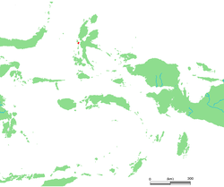
Tidore (Indonesian: Kota Tidore Kepulauan) is a city, island, and archipelago in the Maluku Islands of eastern Indonesia, west of the larger island of Halmahera. In the pre-colonial era, the Sultanate of Tidore was a major regional political and economic power, and a fierce rival of nearby Ternate, just to the north.
Contents
1Geography
2History
3Administration
4Notes
5References
6External links
Geography
Tidore Island consists of a large stratovolcano which rises from the seafloor to an elevation of 1,730 m (5,676 ft) above sea level at the conical Kiematabu Peak on the south end of the island. The northern side of the island contains a caldera, Sabale, with two smaller volcanic cones within it.
Soasio is Tidore's capital. It has its own port, Goto, and it lies on the eastern edge of the island. It has a mini bus terminal and a market. The sultan's palace was rebuilt with completion in 2010.[1]
History
Tidore was a spice-funded sultanate that was founded in 1409, and spent much of its history in the shadow of Ternate, another sultanate.[2]
The sultans of Tidore ruled most of southern Halmahera, and, at times, controlled Buru, Ambon and many of the islands off the coast of New Guinea. Tidore established an alliance with the Spanish in the sixteenth century, and Spain had several forts on the island. There was mutual distrust between the Tidorese and the Spaniards but for the Tidorese the Spanish presence was helpful in resisting the incursions of the Ternateans and their ally, the Dutch, who had a fort on Ternate. For the Spanish, backing the Tidore state helped check the expansion of Dutch power that threatened their nearby Asia-Pacific interests, provided a useful base right next to the centre of Dutch power in the region and was a source of spices for trade.
Before the Spanish withdrawal from Tidore and Ternate in 1663, the Tidore sultanate, although nominally part of the Spanish East Indies, established itself as one of the strongest and most independent states in the region. After the Spanish withdrawal it continued to resist direct control by the Dutch East India Company (the VOC). Particularly under Sultan Saifuddin (r. 1657–1689), the Tidore court was skilled at using Dutch payment for spices for gifts to strengthen traditional ties with Tidore's traditional peripheral territories. As a result, he was widely respected by many local populations, and had little need to call on foreign military help for governing the kingdom, unlike Ternate which frequently relied upon Dutch military assistance.
Tidore long remained an independent state, albeit with growing Dutch interference, until the late eighteenth century. Like Ternate, Tidore allowed the Dutch spice eradication program (extirpatie) to proceed in its territories. This program, intended to strengthen the Dutch spice monopoly by limiting production to a few places, impoverished Tidore and weakened its control over its periphery.
In 1781 Prince Nuku left Tidore and declared himself Sultan of the Papuan Islands. This was the beginning of a guerilla war which lasted for many years. The Papuans sided with the rebellious Prince Nuku. The British had sponsored Nuku as part of their campaign against the Dutch in the Moluccas. Captain Thomas Forrest was intimately connected with Nuku and represented the British as ambassador.
The sultanate was abolished in the Sukarno era and re-established in 1999 with the 36th sultan.[2] Tidore was largely spared from the sectarian conflict of 1999 across the Maluku Islands.[2]
Administration
Tidore Island featured in 1,000-rupiah banknote
The island constitutes a municipality (kotamadya) within the province of North Maluku. The municipality covers an area of 1,645.73 square kilometres (635.42 sq mi) and had a Census population of 90,055 in 2010, the mainland part (Oba) became the city of Sofifi, the new provincial capital. This leaves 53,836 as the population covering 127 km2 of land.[3]
The municipality includes the island of Tidore, together with two small islands (Maitara and Mare), and the Oba section of Halmahera Island. It is divided into eight districts (kecamatan), of which four constitute the island of Tidore (including the two small islands) and the other four constitute the Oba area on the 'mainland' of Halmahera. These are tabulated below with their areas (in sq km) and their populations at the 2010 Census.[4]
Name
English name
Area in sq.km
Population Census 2010
Tidore
(Tidore town)
24.4
18,477
Tidore Selatan
South Tidore
30.1
13,129
Tidore Utara
North Tidore
42.1
14,573
Tidore Timur
East Tidore
30.4
7,657
(totals on Tidore Island)
127.0
53,836
Oba Utara
North Oba
332.4
13,331
Oba Tengah
Central Oba
620.2
7,659
Oba
Oba
430.7
10,337
Oba Selatan
South Oba
173.7
4,892
(totals on Halmahera Island)
1,557.0
36,219
Notes
^Kompas
^ abcWitton, Patrick (2003). Indonesia. Melbourne: Lonely Planet. pp. 827–828. ISBN 1-74059-154-2.
^http://sp2010.bps.go.id/files/ebook/8272.pdf
^Biro Pusat Statistik, Jakarta, 2011.
References
Andaya, Leonard Y. 1993. The world of Maluku: eastern Indonesia in the early modern period. Honolulu: University of Hawaii Press. ISBN 0-8248-1490-8.
External links
Wikisource has the text of the 1911 Encyclopædia Britannica article Tidore.
Wikimedia Commons has media related to Tidore.
The History of the Spanish Presence in the Moluccas (Indonesia): the Spanish Forts in Tidore Island, Maluku, Indonesia by Marco Ramerini
"Tidore". Global Volcanism Program. Smithsonian Institution.
v
t
e
Regencies and cities of North Maluku
Capital: Sofifi
Regencies
Halmahera Barat
Halmahera Selatan
Halmahera Tengah
Halmahera Timur
Halmahera Utara
Morotai Island
Sula Islands
Taliabu Island
Cities
Ternate
Tidore
v
t
e
Islands of Maluku
North Maluku province
Bacan
Halmahera
Kayoa
Moti
Makian
Morotai
Obi
Sula
Ternate
Tidore
Maluku province
Ambelau
Ambon
Aru
Boano
Buru
Babar
Banda
Damar
Haruku
Kai
Kelang
Leti
Liran
Manipa
Manuk
Nila
Nusa Laut
Romang
Saparua
Seram
Serua
Tanimbar
Tayandu
Watubela
Wetar
v
t
e
Spanish Empire
Timeline–immersed
Catholic Monarchs
Treaty of Tordesillas
Italian Wars
Habsburgs
Golden Age
War of the League of Cognac
Encomiendas
New Laws in favour of the indigenous
Expulsion of the Moriscos
Ottoman–Habsburg wars
French Wars of Religion
Bruneian-Spanish conflict
Anglo-Spanish War (1585–1604)
Piracy in the Caribbean
Eighty Years' War
Spanish–Moro conflict
Thirty Years' War
Franco-Spanish War (1635–59)
Portuguese Restoration War
War of the Spanish Succession
Queen Anne's War
Bourbons
Bourbon Reforms
War of Jenkins' Ear
Treaty of Madrid (1750)
Seven Years' War
Nootka Convention
Napoleonic invasion
Third Treaty of San Ildefonso
Independence of Spanish continental Americas
Adams–Onís Treaty
Liberal constitution
Carlist Wars
Spanish–American War
German–Spanish Treaty (1899)
Spanish Civil War
Independence of Morocco
Independence of Equatorial Guinea
Western Sahara conflict
Territories
Kingdoms of Naples, Sicily and Sardinia
Milan
Union with Holy Roman Empire
Netherlands, Belgium, Luxembourg, northernmost France
New Spain (Western United States, Mexico, Central America, Spanish Caribbean)
Spanish Louisiana (Central United States)
Coastal Alaska
Haiti
Belize
Jamaica
Trinidad and Tobago
Venezuela, Western Guyana
New Granada (Panama, Colombia, Ecuador, a northernmost portion of Brazilian Amazon)
Peru (Peru, Acre)
Río de la Plata (Argentina, Paraguay, Charcas (Bolivia), Banda Oriental (Uruguay), Falkland Islands)
Chile
Equatorial Guinea
North Africa (Oran, Tunis, Béjaïa, Peñón of Algiers, Western Sahara, Spanish Morocco, Ifni and Cape Juby)
Administration
Archivo de Indias
Council of the Indies
Cabildo
Exequatur
Laws of the Indies
Papal bull
Royal Decree of Graces
Trial of residence
School of Salamanca
Administrative subdivisions
Viceroyalties
New Spain
New Granada
Perú
Río de la Plata
Audiencias
Bogotá
Buenos Aires
Caracas
Charcas
Concepción
Cusco
Guadalajara
Guatemala
Lima
Manila
Mexico
Panamá
Quito
Santiago
Santo Domingo
Captaincies General
Chile
Cuba
Guatemala
Philippines
Provincias Internas
Puerto Rico
Santo Domingo
Venezuela
Yucatán
Governorates
Castilla de Oro
Cuba
La Florida
Luisiana
New Andalusia (1501–1513)
New Andalusia
New Castile
New Navarre
New Toledo
Paraguay
Río de la Plata
Economy
Currencies
Dollar
Real
Maravedí
Escudo
Columnario
Doubloon
Trade
Manila galleon
Spanish treasure fleet
Casa de Contratación
Spanish Road
Guipuzcoan Company of Caracas
Barcelona Trading Company
Consulate of the Sea
Camino Real de Tierra Adentro
Commerce Consulate of Buenos Aires
Military
Armies
Tercio
Army of Flanders
Free Company of Volunteers of Catalonia
Indian auxiliaries
Spanish Armada
Ships of the line
Royalists
Legión
Strategists
Duke of Alba
Antonio de Leyva
Martín de Goiti
Alfonso d'Avalos
García de Toledo Osorio
Duke of Savoy
Álvaro de Bazán the Elder
John of Austria
Charles Bonaventure de Longueval
Pedro de Zubiaur
Ambrosio Spinola
Blas de Lezo
Bernardo de Gálvez
Mariners
Christopher Columbus
Pinzón brothers
Ferdinand Magellan
Juan Sebastián Elcano
Juan de la Cosa
Juan Ponce de León
Miguel López de Legazpi
Pedro Menéndez de Avilés
Sebastián de Ocampo
Álvar Núñez Cabeza de Vaca
Alonso de Ojeda
Vasco Núñez de Balboa
Alonso de Salazar
Andrés de Urdaneta
Antonio de Ulloa
Ruy López de Villalobos
Diego Columbus
Alonso de Ercilla
Nicolás de Ovando
Juan de Ayala
Sebastián Vizcaíno
Juan Fernández
Felipe González de Ahedo
Conquistadors
Hernán Cortés
Francisco Pizarro
Gonzalo Jiménez de Quesada
Hernán Pérez de Quesada
Francisco Vázquez de Coronado
Diego Velázquez de Cuéllar
Pedro de Valdivia
Gaspar de Portolà
Pere Fages i Beleta
Joan Orpí
Pedro de Alvarado
Martín de Ursúa
Diego de Almagro
Pánfilo de Narváez
Diego de Mazariegos
Jerónimo Luis de Cabrera
Pere d'Alberní i Teixidor
Notable battles
Old World
Won
Comuneros
Bicocca
Rome (1527)
Landriano
Pavia
Tunis
Mühlberg
St. Quentin
Gravelines
Malta
Lepanto
Antwerp
Azores
Mons
Gembloux
Ostend
English Armada
Cape Celidonia
White Mountain
Breda
Nördlingen
Valenciennes
Ceuta
Bitonto
Bailén
Vitoria
Tetouan
Alhucemas
Lost
Capo d'Orso
Vienna (1529)
Preveza
Siege of Castelnuovo
Algiers
Ceresole
Balearic Islands (1558)
Djerba
Tunis
Spanish Armada
Leiden
Rocroi
Downs
Montes Claros
Passaro
Trafalgar
Somosierra
Annual
New World
Won
Tenochtitlan
Cajamarca
Cusco
Bogotá savanna
Reynogüelén
Penco
Guadalupe Island
Recife
San Juan (1595)
Bahia
Colonia del Sacramento
Comuneros (Paraguay)
Cartagena de Indias
Cuerno Verde
Túpac Amaru II
Túpac Katari
Pensacola
Newfoundland
San Juan (1797)
Lost
La Noche Triste
Iguape
Tucapel
Guiana
Comuneros (New Granada)
Trinidad (1797)
Chacabuco
Boyacá
Carabobo
Pichincha
Ayacucho
Guam
Santiago de Cuba
Manila Bay
Asomante
Spanish colonizations
Canary Islands
The Americas
Aztec
Maya
Chiapas
Yucatán
Guatemala
Petén
El Salvador
Honduras
Nicaragua
Chibchan Nations
Colombia
Chile
Inca
The Philippines
Other civil topics
Spanish missions in the Americas
Architecture
Mesoamerican codices
Cusco painting tradition
Indochristian painting in New Spain
Quito painting tradition
Colonial universities in Latin America
Colonial universities in the Philippines
General Archive of the Indies
Colonial Spanish Horse
Mustang
Castas
Old inquisition
Slavery in Spanish Empire
Asiento
Law of coartación (which allowed slaves to buy their freedom, and that of others)
v
t
e
Portuguese overseas empire
North Africa
15th century
1415–1640
Ceuta
1458–1550
Alcácer Ceguer (El Qsar es Seghir)
1471–1550
Arzila (Asilah)
1471–1662
Tangier
1485–1550
Mazagan (El Jadida)
1487–16th century
Ouadane
1488–1541
Safim (Safi)
1489
Graciosa
16th century
1505–1541
Santa Cruz do Cabo de Gué (Agadir)
1506–1525
Mogador (Essaouira)
1506–1525
Aguz (Souira Guedima)
1506–1769
Mazagan (El Jadida)
1513–1541
Azamor (Azemmour)
1515–1541
São João da Mamora (Mehdya)
1577–1589
Arzila (Asilah)
Sub-Saharan Africa
15th century
1455–1633
Anguim
1462–1975
Cape Verde
1470–1975
São Tomé1
1471–1975
Príncipe1
1474–1778
Annobón
1478–1778
Fernando Poo (Bioko)
1482–1637
Elmina (São Jorge da Mina)
1482–1642
Portuguese Gold Coast
1508–15472
Madagascar3
1498–1540
Mascarene Islands
16th century
1500–1630
Malindi
1501–1975
Portuguese Mozambique
1502–1659
Saint Helena
1503–1698
Zanzibar
1505–1512
Quíloa (Kilwa)
1506–1511
Socotra
1557–1578
Accra
1575–1975
Portuguese Angola
1588–1974
Cacheu4
1593–1698
Mombassa (Mombasa)
17th century
1645–1888
Ziguinchor
1680–1961
São João Baptista de Ajudá
1687–1974
Bissau4
18th century
1728–1729
Mombassa (Mombasa)
1753–1975
Portuguese São Tomé and Príncipe
19th century
1879–1974
Portuguese Guinea
1885–1974
Portuguese Congo5
1 Part of São Tomé and Príncipe from 1753.
2 Or 1600.
3 A factory (Anosy Region) and small temporary coastal bases.
4 Part of Portuguese Guinea from 1879.
5 Part of Portuguese Angola from the 1920s.
Middle East [Persian Gulf]
16th century
1506–1615
Gamru (Bandar Abbas)
1507–1643
Sohar
1515–1622
Hormuz (Ormus)
1515–1648
Quriyat
1515–?
Qalhat
1515–1650
Muscat
1515?–?
Barka
1515–1633?
Julfar (Ras al-Khaimah)
1521–1602
Bahrain (Muharraq • Manama)
1521–1529?
Qatif
1521?–1551?
Tarut Island
1550–1551
Qatif
1588–1648
Matrah
17th century
1620–?
Khor Fakkan
1621?–?
As Sib
1621–1622
Qeshm
1623–?
Khasab
1623–?
Libedia
1624–?
Kalba
1624–?
Madha
1624–1648
Dibba Al-Hisn
1624?–?
Bandar-e Kong
Indian subcontinent
15th century
1498–1545
Laccadive Islands (Lakshadweep)
16th century
Portuguese India
• 1500–1663
Cochim (Kochi)
• 1501–1663
Cannanore (Kannur)
• 1502–1658 1659–1661
Quilon (Coulão / Kollam)
• 1502–1661
Pallipuram (Cochin de Cima)
• 1507–1657
Negapatam (Nagapatnam)
• 1510–1961
Goa
• 1512–1525 1750
Calicut (Kozhikode)
• 1518–1619
Portuguese Paliacate outpost (Pulicat)
• 1521–1740
Chaul
(Portuguese India)
• 1523–1662
Mylapore
• 1528–1666
Chittagong (Porto Grande De Bengala)
• 1531–1571
Chaul
• 1531–1571
Chalé
• 1534–1601
Salsette Island
• 1534–1661
Bombay (Mumbai)
• 1535
Ponnani
• 1535–1739
Baçaím (Vasai-Virar)
• 1536–1662
Cranganore (Kodungallur)
• 1540–1612
Surat
• 1548–1658
Tuticorin (Thoothukudi)
• 1559–1961
Daman and Diu
• 1568–1659
Mangalore
(Portuguese India)
• 1579–1632
Hugli
• 1598–1610
Masulipatnam (Machilipatnam)
1518–1521
Maldives
1518–1658
Portuguese Ceylon (Sri Lanka)
1558–1573
Maldives
17th century
Portuguese India
• 1687–1749
Mylapore
18th century
Portuguese India
• 1779–1954
Dadra and Nagar Haveli
East Asia and Oceania
16th century
1511–1641
Portuguese Malacca [Malaysia]
1512–1621
Maluku [Indonesia]
• 1522–1575
Ternate
• 1576–1605
Ambon
• 1578–1650
Tidore
1512–1665
Makassar
1557–1999
Macau [China]
1580–1586
Nagasaki [Japan]
17th century
1642–1975
Portuguese Timor (East Timor)1
19th century
Portuguese Macau
• 1864–1999
Coloane
• 1851–1999
Taipa
• 1890–1999
Ilha Verde
20th century
Portuguese Macau
• 1938–1941
Lapa and Montanha (Hengqin)
1 1975 is the year of East Timor's Declaration of Independence and subsequent invasion by Indonesia. In 2002, East Timor's independence was fully recognized.
Clash Royale CLAN TAG #URR8PPP Executable numpy error I'm trying to create an executable file for my code. I've already tried with cx_Freeze and with pyinstaller. Both gives me the same error, which is: "Missing required dependencies 0.format(missing_dependencies))" PS C:UsersGustavoDesktopbuildexe.win32-3.6> python AgendaOficial.py C:UsersGustavoAppDataLocalProgramsPythonPython36-32python.exe: can't open file 'AgendaOficial.py': [Errno 2] No such file or directory PS C:UsersGustavoDesktopbuildexe.win32-3.6> .AgendaOficial.exe Traceback (most recent call last): File "C:UsersGustavoAppDataLocalProgramsPythonPython36-32libsite-packagescx_Freezeinitscripts__startup__.py", line 14, in run module.run() File "C:UsersGustavoAppDataLocalProgramsPythonPython36-32libsite-packagescx_FreezeinitscriptsConsole.py", line 26, in run exec(code, m. dict ) File "AgendaOficial.py", line 8, in File "C:UsersGustavoAppDataLocal...
Clash Royale CLAN TAG #URR8PPP Trying to Print Gridster Items to PDF without overlapping contents I want to print gridster items to pdf using chome browser. Unfortunately the item overlaps on next page. Is there any way to make gridster item go to next page if it doesnt fit in the current page when printing to pdf? Screenshot By clicking "Post Your Answer", you acknowledge that you have read our updated terms of service, privacy policy and cookie policy, and that your continued use of the website is subject to these policies.
Clash Royale CLAN TAG #URR8PPP Mass disable jenkins jobs Is it possible to disable a large number of Jenkins jobs in one go? I have a large number of jenkins job I need to disable. Visiting each job in turn and disbling is tedious. 2 Answers 2 https://wiki.jenkins-ci.org/display/JENKINS/Configuration+Slicing+Plugin That works beautifully install it go to http://your_jenkins.com:8080/slicing/jobdisabledbool/? By using configuration slicing plugin: By using this plugin easy to find out anything has enabled or disable jobs and timer separated jobs Manage Jenkins >Config slicing > select options By clicking "Post Your Answer", you acknowledge that you have read our updated terms of service, privacy policy and cookie policy, and that your continued use of the website is subject to these policies.
 Mixing


 Clash Royale CLAN TAG#URR8PPP
Comments
Post a Comment