 Mixing
City of Port Melbourne
City of Port Melbourne Victoria | |||||||||||||||
|---|---|---|---|---|---|---|---|---|---|---|---|---|---|---|---|
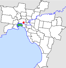 Location in Melbourne | |||||||||||||||
 The former Port Melbourne Town Hall | |||||||||||||||
| Population | 7,900 (1992)[1] | ||||||||||||||
| • Density | 744/km2 (1,927/sq mi) | ||||||||||||||
| Established | 1860 | ||||||||||||||
| Area | 10.62 km2 (4.1 sq mi) | ||||||||||||||
| Council seat | Port Melbourne | ||||||||||||||
| Region | Melbourne | ||||||||||||||
| County | Bourke | ||||||||||||||
| |||||||||||||||
The City of Port Melbourne was a local government area about 4 kilometres (2 mi) southwest of Melbourne, the state capital of Victoria, Australia, on the south bank of the Yarra River. The city covered an area of 10.62 square kilometres (4.10 sq mi), and existed from 1860 until 1994.
The council area covered the current boundaries of the suburb of Port Melbourne; the Yarra River to the west and north, Boundary Street to the northeast, Hobsons Bay to the south and Pickles Street to the east.[2]
Contents
1 History
2 Wards
3 Population
4 References
History
Port Melbourne was first incorporated as the Sandridge Borough on 13 July 1860. It was renamed Port Melbourne on 25 January 1884, and became a town on 20 January 1893. It was proclaimed a city on 14 May 1919.[2]
The Labor Party normally dominated the council. In 1992 Lyn Allison was elected to the council as an Independent, a position she held until 1994.[3] Allison was later elected as a member of the Australian Senate and she also served as Leader of the Australian Democrats.
On 22 June 1994, the City of Port Melbourne was abolished, and, along with the Cities of South Melbourne and St Kilda, was merged into the newly created City of Port Phillip.[4]
The council met at the Port Melbourne Town Hall, at Bay Street and Spring Street, Port Melbourne. The facility is now used as a municipal library by the City of Port Phillip.
Wards
The City of Port Melbourne was divided into three wards, each electing three councillors:
- Boundary Ward
- Centre Ward
- Sandridge Ward
Population
| Year | Population |
|---|---|
| 1954 | 13,104 |
| 1958 | 12,700* |
| 1961 | 12,370 |
| 1966 | 12,596 |
| 1971 | 11,705 |
| 1976 | 9,356 |
| 1981 | 8,585 |
| 1986 | 8,080 |
| 1991 | 7,496 |
* Estimate in the 1958 Victorian Year Book.
References
^ Australian Bureau of Statistics, Victoria Office (1994). Victorian Year Book. p. 49. ISSN 0067-1223.
^ ab Victorian Municipal Directory. Brunswick: Arnall & Jackson. 1992. pp. 453–454. Accessed at State Library of Victoria, La Trobe Reading Room.
^ Ainsley Symons (2012), "The Democrats and Local Government. Were they ever a threat to the ALP?" in Recorder (Australian Society for the Study of Labour History, Melbourne Branch) No. 274, Page 7.
^ Australian Bureau of Statistics (1 August 1995). Victorian local government amalgamations 1994-1995: Changes to the Australian Standard Geographical Classification (PDF). Commonwealth of Australia. p. 11. ISBN 0-642-23117-6. Retrieved 2007-12-16.
Coordinates: 37°49′26″S 144°54′40″E / 37.824°S 144.911°E / -37.824; 144.911

 Clash Royale CLAN TAG#URR8PPP
Comments
Post a Comment