 Mixing

Baradine County
Baradine New South Wales | |||||||||||||||
|---|---|---|---|---|---|---|---|---|---|---|---|---|---|---|---|
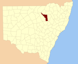 Location in New South Wales | |||||||||||||||
| |||||||||||||||
Baradine County is one of the 141 Cadastral divisions of New South Wales. It is bounded in the north by the Namoi River, and includes the land south to Coonabarabran, which is on its southern edge. This includes land on both sides of the Baradine Creek and the town of Baradine.
Baradine is believed to be derived from a local Aboriginal word.[1]
Parishes within the county
A full list of parishes found within this county; their current LGA and mapping coordinates to the approximate centre of each location is as follows:
| Parish | LGA | Coordinates |
|---|---|---|
| Badham | Warrumbungle Shire | 30°57′54″S 149°20′04″E / 30.96500°S 149.33444°E / -30.96500; 149.33444 (Badham Parish) |
| Baradine | Warrumbungle Shire | 30°55′33″S 149°02′34″E / 30.92583°S 149.04278°E / -30.92583; 149.04278 (Baradine Parish) |
| Barwon | Warrumbungle Shire | 30°59′54″S 148°55′04″E / 30.99833°S 148.91778°E / -30.99833; 148.91778 (Barwon Parish) |
| Berigerie | Warrumbungle Shire | 30°51′54″S 148°56′04″E / 30.86500°S 148.93444°E / -30.86500; 148.93444 (Berigerie Parish) |
| Berrybah | Walgett Shire | 30°19′54″S 148°34′04″E / 30.33167°S 148.56778°E / -30.33167; 148.56778 (Berrybah Parish) |
| Boorimah | Narrabri Shire | 30°04′54″S 149°37′04″E / 30.08167°S 149.61778°E / -30.08167; 149.61778 (Boorimah Parish) |
| Bugaldie | Warrumbungle Shire | 31°05′54″S 149°09′04″E / 31.09833°S 149.15111°E / -31.09833; 149.15111 (Bugaldie Parish) |
| Bullerawa | Narrabri Shire | 30°21′54″S 149°05′04″E / 30.36500°S 149.08444°E / -30.36500; 149.08444 (Bullerawa Parish) |
| Bulliwy | Walgett Shire | 30°30′54″S 148°47′04″E / 30.51500°S 148.78444°E / -30.51500; 148.78444 (Bulliwy Parish) |
| Bundill | Narrabri Shire | 30°10′54″S 149°32′05″E / 30.18167°S 149.53472°E / -30.18167; 149.53472 (Bundill Parish) |
| Bungle Gully | Walgett Shire | 30°17′54″S 148°30′04″E / 30.29833°S 148.50111°E / -30.29833; 148.50111 (Bungle Gully Parish) |
| Carlo | Warrumbungle Shire | 31°04′54″S 149°20′04″E / 31.08167°S 149.33444°E / -31.08167; 149.33444 (Carlo Parish) |
| Ceelnoy | Warrumbungle Shire | 30°39′54″S 148°52′04″E / 30.66500°S 148.86778°E / -30.66500; 148.86778 (Ceelnoy Parish) |
| Coolangoola | Warrumbungle Shire | 30°51′54″S 149°10′04″E / 30.86500°S 149.16778°E / -30.86500; 149.16778 (Coolangoola Parish) |
| Coomore | Narrabri Shire | 30°42′54″S 149°13′04″E / 30.71500°S 149.21778°E / -30.71500; 149.21778 (Coomore Parish) |
| Coomore South | Narrabri Shire | 30°46′54″S 149°14′04″E / 30.78167°S 149.23444°E / -30.78167; 149.23444 (Coomore South Parish) |
| Cooper | Warrumbungle Shire | 31°01′54″S 149°15′04″E / 31.03167°S 149.25111°E / -31.03167; 149.25111 (Cooper Parish) |
| Cox | Walgett Shire | 30°19′54″S 148°26′04″E / 30.33167°S 148.43444°E / -30.33167; 148.43444 (Cox Parish) |
| Cubbo | Narrabri Shire | 30°34′54″S 149°07′04″E / 30.58167°S 149.11778°E / -30.58167; 149.11778 (Cubbo Parish) |
| Culnooy | Walgett Shire | 30°31′54″S 148°36′04″E / 30.53167°S 148.60111°E / -30.53167; 148.60111 (Culnooy Parish) |
| Cumberdoon | Walgett Shire | 30°13′54″S 148°22′04″E / 30.23167°S 148.36778°E / -30.23167; 148.36778 (Cumberdoon Parish) |
| Cumbil | Narrabri Shire | 30°46′54″S 149°09′04″E / 30.78167°S 149.15111°E / -30.78167; 149.15111 (Cumbil Parish) |
| Dandry | Warrumbungle Shire | 31°09′54″S 149°18′04″E / 31.16500°S 149.30111°E / -31.16500; 149.30111 (Dandry Parish) |
| Dangar | Walgett Shire | 30°18′54″S 148°40′04″E / 30.31500°S 148.66778°E / -30.31500; 148.66778 (Dangar Parish) |
| Denevoli | Walgett Shire | 30°24′54″S 148°31′04″E / 30.41500°S 148.51778°E / -30.41500; 148.51778 (Denevoli Parish) |
| Doyle | Walgett Shire | 30°07′54″S 148°16′04″E / 30.13167°S 148.26778°E / -30.13167; 148.26778 (Doyle Parish) |
| Dubbo | Narrabri Shire | 30°26′54″S 149°06′04″E / 30.44833°S 149.10111°E / -30.44833; 149.10111 (Dubbo Parish) |
| Dunwerian | Narrabri Shire | 30°37′54″S 149°12′04″E / 30.63167°S 149.20111°E / -30.63167; 149.20111 (Dunwerian Parish) |
| Etoo | Narrabri Shire | 30°31′54″S 149°03′04″E / 30.53167°S 149.05111°E / -30.53167; 149.05111 (Etoo Parish) |
| Euligal | Narrabri Shire | 30°41′54″S 149°05′04″E / 30.69833°S 149.08444°E / -30.69833; 149.08444 (Euligal Parish) |
| Evans | Walgett Shire | 30°19′54″S 148°20′04″E / 30.33167°S 148.33444°E / -30.33167; 148.33444 (Evans Parish) |
| Gidgenbar | Coonamble Shire | 30°39′54″S 148°46′04″E / 30.66500°S 148.76778°E / -30.66500; 148.76778 (Gidgenbar Parish) |
| Ginee | Walgett Shire | 30°33′54″S 148°41′04″E / 30.56500°S 148.68444°E / -30.56500; 148.68444 (Ginee Parish) |
| Goangra | Walgett Shire | 30°09′54″S 148°22′04″E / 30.16500°S 148.36778°E / -30.16500; 148.36778 (Goangra Parish) |
| Goorianawa | Warrumbungle Shire | 31°03′54″S 148°55′04″E / 31.06500°S 148.91778°E / -31.06500; 148.91778 (Goorianawa Parish) |
| Gora | Warrumbungle Shire | 31°04′54″S 149°00′04″E / 31.08167°S 149.00111°E / -31.08167; 149.00111 (Gora Parish) |
| Gwabegar | Narrabri Shire | 30°35′54″S 148°52′04″E / 30.59833°S 148.86778°E / -30.59833; 148.86778 (Gwabegar Parish) |
| Hall | Warrumbungle Shire | 30°57′54″S 149°05′04″E / 30.96500°S 149.08444°E / -30.96500; 149.08444 (Hall Parish) |
| Jamalong | Walgett Shire | 30°25′54″S 148°26′04″E / 30.43167°S 148.43444°E / -30.43167; 148.43444 (Jamalong Parish) |
| Kenebri | Warrumbungle Shire | 30°49′54″S 148°58′04″E / 30.83167°S 148.96778°E / -30.83167; 148.96778 (Kenebri Parish) |
| Leslie | Warrumbungle Shire | 31°11′54″S 148°59′04″E / 31.19833°S 148.98444°E / -31.19833; 148.98444 (Leslie Parish) |
| Mackenzie | Warrumbungle Shire | 30°46′54″S 149°04′04″E / 30.78167°S 149.06778°E / -30.78167; 149.06778 (Mackenzie Parish) |
| Mcfarlane | Walgett Shire | 30°13′54″S 148°16′04″E / 30.23167°S 148.26778°E / -30.23167; 148.26778 (Mcfarlane Parish) |
| Meit | Walgett Shire | 30°25′54″S 148°49′04″E / 30.43167°S 148.81778°E / -30.43167; 148.81778 (Meit Parish) |
| Merebene | Warrumbungle Shire | 30°39′54″S 148°58′04″E / 30.66500°S 148.96778°E / -30.66500; 148.96778 (Merebene Parish) |
| Merimborough | Narrabri Shire | 30°29′54″S 149°12′04″E / 30.49833°S 149.20111°E / -30.49833; 149.20111 (Merimborough Parish) |
| Merritombea | Walgett Shire | 30°03′54″S 148°08′04″E / 30.06500°S 148.13444°E / -30.06500; 148.13444 (Merritombea Parish) |
| Midgee | Walgett Shire | 30°29′54″S 148°37′04″E / 30.49833°S 148.61778°E / -30.49833; 148.61778 (Midgee Parish) |
| Milchomi | Walgett Shire | 30°23′54″S 148°38′04″E / 30.39833°S 148.63444°E / -30.39833; 148.63444 (Milchomi Parish) |
| Miller | Warrumbungle Shire | 30°44′54″S 148°58′04″E / 30.74833°S 148.96778°E / -30.74833; 148.96778 (Miller Parish) |
| Minnon | Narrabri Shire | 30°26′54″S 149°01′04″E / 30.44833°S 149.01778°E / -30.44833; 149.01778 (Minnon Parish) |
| Moglewit | Narrabri Shire | 30°21′54″S 149°00′04″E / 30.36500°S 149.00111°E / -30.36500; 149.00111 (Moglewit Parish) |
| Muttama | Walgett Shire | 30°30′54″S 148°31′04″E / 30.51500°S 148.51778°E / -30.51500; 148.51778 (Muttama Parish) |
| Newman | Walgett Shire | 30°19′54″S 148°45′04″E / 30.33167°S 148.75111°E / -30.33167; 148.75111 (Newman Parish) |
| Orr | Warrumbungle Shire | 31°00′55″S 149°30′04″E / 31.01528°S 149.50111°E / -31.01528; 149.50111 (Orr Parish) |
| Parsons | Warrumbungle Shire | 30°59′54″S 149°08′04″E / 30.99833°S 149.13444°E / -30.99833; 149.13444 (Parsons Parish) |
| Pilliga | Walgett Shire | 30°19′54″S 148°50′04″E / 30.33167°S 148.83444°E / -30.33167; 148.83444 (Pilliga Parish) |
| Quegobla | Narrabri Shire | 30°29′54″S 148°54′04″E / 30.49833°S 148.90111°E / -30.49833; 148.90111 (Quegobla Parish) |
| Rundle | Warrumbungle Shire | 31°08′54″S 149°03′04″E / 31.14833°S 149.05111°E / -31.14833; 149.05111 (Rundle Parish) |
| Tallama | Warrumbungle Shire | 30°50′54″S 149°05′04″E / 30.84833°S 149.08444°E / -30.84833; 149.08444 (Tallama Parish) |
| Talluba | Narrabri Shire | 30°20′54″S 148°56′04″E / 30.34833°S 148.93444°E / -30.34833; 148.93444 (Talluba Parish) |
| Teni | Narrabri Shire | 30°25′54″S 148°54′04″E / 30.43167°S 148.90111°E / -30.43167; 148.90111 (Teni Parish) |
| Terembone | Coonamble Shire | 30°38′50″S 148°40′12″E / 30.64722°S 148.67000°E / -30.64722; 148.67000 (Terembone Parish) |
| Teridgerie | Warrumbungle Shire | 30°48′11″S 148°53′37″E / 30.80306°S 148.89361°E / -30.80306; 148.89361 (Teridgerie Parish) |
| Tunis | Narrabri Shire | 30°21′54″S 149°10′04″E / 30.36500°S 149.16778°E / -30.36500; 149.16778 (Tunis Parish) |
| Ukerbarley | Warrumbungle Shire | 31°14′54″S 149°08′04″E / 31.24833°S 149.13444°E / -31.24833; 149.13444 (Ukerbarley Parish) |
| Ulambie | Walgett Shire | 30°05′54″S 148°12′04″E / 30.09833°S 148.20111°E / -30.09833; 148.20111 (Ulambie Parish) |
| Urawilkie | Coonamble Shire | 30°42′54″S 148°45′04″E / 30.71500°S 148.75111°E / -30.71500; 148.75111 (Urawilkie Parish) |
| Wambadule | Walgett Shire | 30°24′54″S 148°43′04″E / 30.41500°S 148.71778°E / -30.41500; 148.71778 (Wambadule Parish) |
| Wangan | Narrabri Shire | 30°34′54″S 148°58′04″E / 30.58167°S 148.96778°E / -30.58167; 148.96778 (Wangan Parish) |
| Wheoh | Warrumbungle Shire | 31°14′54″S 149°04′04″E / 31.24833°S 149.06778°E / -31.24833; 149.06778 (Wheoh Parish) |
| White | Warrumbungle Shire | 30°43′54″S 148°52′04″E / 30.73167°S 148.86778°E / -30.73167; 148.86778 (White Parish) |
| Wittenbra | Warrumbungle Shire | 31°02′54″S 149°14′04″E / 31.04833°S 149.23444°E / -31.04833; 149.23444 (Wittenbra Parish) |
| Worigal | Warrumbungle Shire | 30°56′54″S 149°09′04″E / 30.94833°S 149.15111°E / -30.94833; 149.15111 (Worigal Parish) |
| Yarraman | Coonamble Shire | 30°33′54″S 148°47′04″E / 30.56500°S 148.78444°E / -30.56500; 148.78444 (Yarraman Parish) |
| Yarren | Walgett Shire | 30°31′54″S 148°43′04″E / 30.53167°S 148.71778°E / -30.53167; 148.71778 (Yarren Parish) |
| Yarrigan | Warrumbungle Shire | 30°59′54″S 149°00′04″E / 30.99833°S 149.00111°E / -30.99833; 149.00111 (Yarrigan Parish) |
| Yearanan | Warrumbungle Shire | 31°08′54″S 148°59′04″E / 31.14833°S 148.98444°E / -31.14833; 148.98444 (Yearanan Parish) |
References
^ "Baradine". Geographical Names Register (GNR) of NSW. Geographical Names Board of New South Wales.

 Clash Royale CLAN TAG#URR8PPP
Comments
Post a Comment