 Mixing

Walgett Shire
Walgett Shire New South Wales | |||||||||||||||
|---|---|---|---|---|---|---|---|---|---|---|---|---|---|---|---|
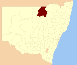 Location in New South Wales | |||||||||||||||
| Coordinates | 30°01′S 148°07′E / 30.017°S 148.117°E / -30.017; 148.117Coordinates: 30°01′S 148°07′E / 30.017°S 148.117°E / -30.017; 148.117 | ||||||||||||||
| Population | 6,107 (2016 census)[1] | ||||||||||||||
| • Density | 0.273415/km2 (0.70814/sq mi) | ||||||||||||||
| Established | 7 March 1906 (1906-03-07) | ||||||||||||||
| Area | 22,336 km2 (8,624.0 sq mi) | ||||||||||||||
| Mayor | Ian Woodcock (Unaligned) | ||||||||||||||
| Council seat | Walgett | ||||||||||||||
| Region | Orana | ||||||||||||||
| State electorate(s) | Barwon | ||||||||||||||
| Federal Division(s) | Parkes | ||||||||||||||
| Website | Walgett Shire | ||||||||||||||
| |||||||||||||||
Walgett Shire is a local government area in the Orana region of New South Wales, Australia. The northern boundary of the Shire is located adjacent to the border between New South Wales and Queensland. The town of Walgett is located at the junction of the Barwon River and the Namoi River, and at the junction of the Kamilaroi Highway and the Castlereagh Highway.
The Shire is divided between the agricultural areas (producing wool, cattle, wheat and cotton), which are near the Barwon and Namoi rivers or southeast of the Barwon River, and the outback country northwest of the Barwon River, including the black opal mining and fossicking town of Lightning Ridge. Prior to 1957, when Lightning Ridge was established as a significant settlement, the outback country was part of the Western Division.
The Mayor of Walgett Shire Council is Cr. Ian Woodcock, who is unaligned with any political party.
Contents
1 Towns and villages
2 Heritage listings
3 Demographics
4 Council
4.1 Current composition and election method
5 References
6 External links
Towns and villages
Walgett Shire includes Walgett, Lightning Ridge, Collarenebri, Pilliga, Pokataroo, Rowena, Burren Junction, Cryon, Cumborah, Glengarry and Carinda. Come By Chance was established in 1840, before all of the above towns and villages.
Heritage listings
Walgett Shire has a number of heritage-listed sites, including:
- Collarenebri, Gundabloui Road: Collarenebri Aboriginal Cemetery[2]
Demographics
According to the Australian Bureau of Statistics during 2003-04 there:[3]
- were 1,726 wage and salary earners (ranked 123rd in New South Wales and 393rd in Australia, less than 0.1% of both New South Wales's 2,558,415 and Australia's 7,831,856)
- was a total income of $55 million (ranked 121st in New South Wales and 391st in Australia, less than 0.1% of both New South Wales's $107 billion and Australia's $304 billion)
- was an estimated average income per wage and salary earner of $31,980 (ranked 112th in New South Wales and 376th in Australia, 77% of New South Wales's $41,407 and 82% of Australia's $38,820)
- was an estimated median income per wage and salary earner of $29,155 (ranked 119th in New South Wales and 406th in Australia, 82% of New South Wales's $35,479 and 85% of Australia's $34,149).
| Selected historical census data for Walgett Shire local government area | ||||||
|---|---|---|---|---|---|---|
| Census year | 2011[4] | 2016[1] | ||||
| Population | Estimated residents on census night | 6,454 | ||||
| LGA rank in terms of size within New South Wales | 7002106000000000000♠106th | |||||
| % of New South Wales population | ||||||
| % of Australian population | ||||||
| Cultural and language diversity | ||||||
Ancestry, top responses | English | |||||
| Australian | ||||||
| Italian | ||||||
| Chinese | ||||||
| Irish | ||||||
| Language, top responses (other than English) | Italian | |||||
| Mandarin | ||||||
| Cantonese | ||||||
| Korean | ||||||
| Greek | ||||||
| Religious affiliation | ||||||
Religious affiliation, top responses | Catholic | |||||
| No religion | ||||||
| Anglican | ||||||
| Eastern Orthodox | ||||||
| Buddhism | ||||||
| Median weekly incomes | ||||||
| Personal income | Median weekly personal income | A$ | ||||
| % of Australian median income | ||||||
| Family income | Median weekly family income | |||||
| % of Australian median income | ||||||
| Household income | Median weekly household income | |||||
| % of Australian median income | ||||||
Council

Walgett Shire Council
Between 2004 and 2008, the Council was controlled by an Administrator, Vic Smith,[5] appointed by the New South Wales Minister for Local Government. The previous Walgett Shire Council was split between factions representing Lightning Ridge and the rest of the Shire and apparently became unworkable as a result. In 2004, a public inquiry investigated the dispute, among other things, under the Local Government Act, 1993 (NSW). Other matters investigated included poor administration, failure to properly inform Councillors in relation to some matters, apparently illegal walkouts by some Councilors to frustrate votes and, in particular, events surrounding a failed project to build a community centre in Lightning Ridge.[6]
Current composition and election method
Walgett Shire Council is composed of nine Councillors elected proportionally as a single ward. All Councillors are elected for a fixed four-year term of office. The Mayor is elected by the Councillors at the first meeting of the Council. The most recent election was held on 10 September 2016, and the makeup of the Council is as follows:[7]
| Party | Councillors | |
|---|---|---|
| | Unaligned | 9 |
Total | 9 | |
The current Council, elected in 2016, in order of election, is:[7]
| Councillor | Party | Notes | |
|---|---|---|---|
| Ian Woodcock | | Unaligned | Mayor[8] |
| Jane Keir | | Unaligned | |
| Laurence Walford | | Unaligned | |
| Bill Murray | | Independent | |
| Michael Taylor | | Unaligned | |
| Manuel Martinez | | Unaligned | Deputy Mayor[8] |
| Robbie Turnbull | | Unaligned | |
| Tanya Cameron | | Unaligned | |
| Kelly Smith | | Unaligned | |
References
^ ab Australian Bureau of Statistics (27 June 2017). "Walgett (A)". 2016 Census QuickStats. Retrieved 7 July 2017.
^ "Collarenebri Aboriginal Cemetery, New South Wales State Heritage Register (NSW SHR) Number H01934". New South Wales State Heritage Register. Office of Environment and Heritage. Retrieved 18 May 2018.
^ "Regional Wage and Salary Earner Statistics, Australia (catalogue no.: 5673.055.003)". Australian Bureau of Statistics. Retrieved 11 March 2007.
^ Australian Bureau of Statistics (31 October 2012). "Walgett (A)". 2011 Census QuickStats. Retrieved 23 October 2012.
^ "Local Government Directory". Division of Local Government. June 2004. Retrieved 14 November 2006.
^ Bulford, Robert (June 2004). Walgett Shire Council Public Enquiry (PDF). Division of Local Government. p. 89. ISBN 1-920766-10-3. Retrieved 14 November 2006.
^ ab "Walgett Shire Council: Summary of First Preference Votes for each Candidate". Local Government Elections 2016. Electoral Commission of New South Wales. 19 September 2016. Retrieved 3 November 2016.
^ ab Media, Australian Community Media - Fairfax (2016-09-28). "New mayor for Walgett". Daily Liberal. Retrieved 2016-11-03.
External links
![]() Media related to Walgett Shire at Wikimedia Commons
Media related to Walgett Shire at Wikimedia Commons
- Walgett Shire Council official website

 Clash Royale CLAN TAG#URR8PPP
Comments
Post a Comment